Dales High Way & the Teesdale Way - 2011


Day one Thursday 21st April – Saltaire to Ilkley – 7.5 miles
This walk originated in the depths of a horrible winter out of mental desperation to get out there and also to send a firm message to my body that bad backs, knees, and shoulders would no longer be tolerated. The bad back, knees and shoulders did have a fair comment however in that the belly really was getting too large – and the brain made the bold statement prior to departure that the belly would be deposited out on the moors. Grumpus said I couldn’t do that - it could slither up and attach itself to someone else.
The Dales High Way was developed by Tony & Chris Grogan as a high level alternative to the Dales Way, running from the Grogan’s home in Saltaire to Appleby – with the intention being that walkers could reprise their walk at the end on the Settle to Carlisle railway. My intention had been to walk over the Easter bank holiday and to snuff out the royal wedding. So I needed a few days more walking and chose to head onto the Pennines at High Cup Nick (one of my favourite places in the universe) and then follow the Teesdale Way into Darlington.
Whether my knees would be strong enough to carry my 17 stone plus my 2 stone rucksack became immaterial in the preceding days as I broke a tooth and eventually decided that I needed some emergency treatment on the day of departure. Happily my dentist fitted me in early on and sorted things out and Grumpus deposited me at New Street station for the somewhat packed 12.10 train to Leeds – which seemed to take forever. The little train from Leeds to Saltaire was much quicker – only allowing me time to plaster on sun cream and put boots on.


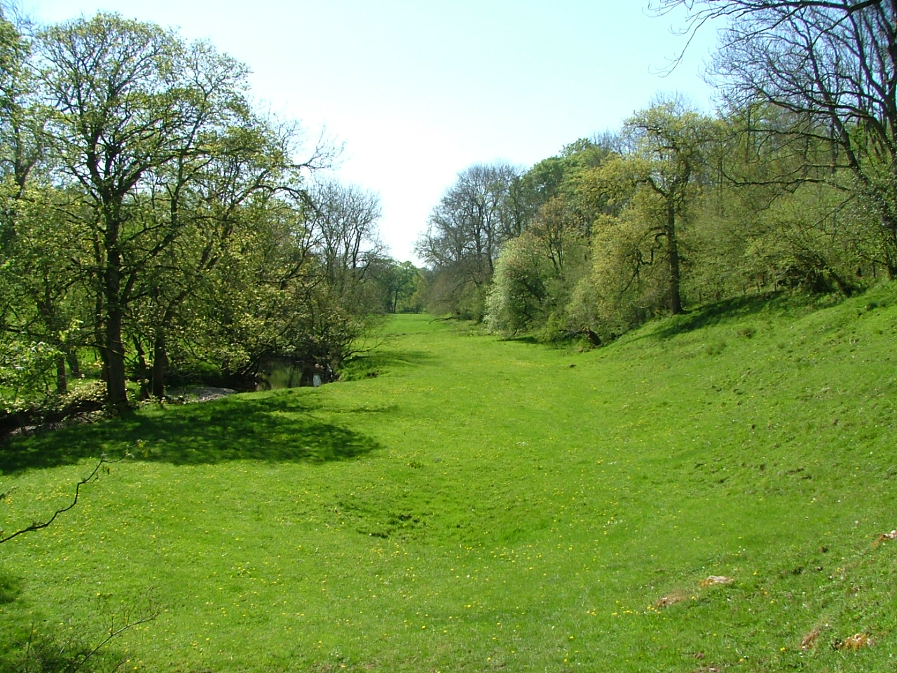
Titus Salt’s mill would have been interesting to visit, but I just wanted to get going – it felt good to be striding purposefully along the Leeds Liverpool Canal and then up through the boulder strewn and ancient Trench Wood. The weather and the ongoing forecast were astonishingly spectacular.


Emerging into the open under Hope Hill – which the guide presented as an option to climb (declined) - the path meandered over a horseriding track – not easy to walk on – and then around Weecher Reservoir. The water levels were very low, but on the local news later on, I discovered that this was because of works being done on the reservoir, not the lack of rain. These works prevented me from taking the short cut onto the moors, but not too sure that I wanted to encounter the particularly angry looking cows in that direction. Bingley Moor was a welcome return to windswept moorland. Somewhere round here, I received my first text from my friend Susie – with Grumpus being abroad, I had given her my itinerary, and our exchanges of text during the walk proved comforting.


Bingley Moor became Ilkley Moor, and I parked myself in the centre of the Twelve Apostles stone circle – my reveries punctuated by several stringy runners, and an assortment of birds chirruping, whirring, and clicking in the heat haze. With views down Wharfedale lost in the haze that was to mark the first three days, the descent through Ilkley Crags and past White Wells was tough on the knees, but I was happy enough to edge my way past the throngs out in Ilkley to the Riverside Hotel. In my book on Africa, homo sapiens sapiens had eventually made an appearance, and it turned out that DNA evidence had shown that all humanity had derived from one woman. The book also made the point that a key reason why humans had been successful was because of their efficient means of losing heat – although a drawback had been the amount of food needed to feed the brain …


Day two Friday 22nd April – Ilkley to Skipton – 11.5 miles
… sleep is also good to feed the brain as well. Craziness in the pub – evidence of which was on show in the bar in the morning – had kept me awake until about 1am. Oh well. Everything aches and I’m tired but I’m off at 8.15 up through Ilkley and onto the moor. It was sure a beautiful walk along the ridge, but the “long views over Upper Wharfedale” announced by the guidebook were not available due to the haze.
If I had been in any doubt about where I needed to turn off to descend the ridge to Addingham – and it did seem to come on me sooner than I expected – the appearance of the Hound of Windgate Nick would have alerted me to the fact that something was happening! Post walk investigations revealed that no one actually knows who put the hound there, but it can be seen for miles around.


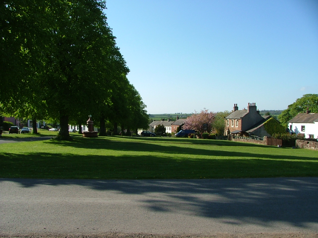
The green meadows of Addingham and the subsequent arrow straight Rombalds Way were pleasant enough, but I found myself coming down the tree lined avenue into Skipton (past the old toll house where a young girl asked me if I was going fishing) before 2pm, and I started to realise that the distances that the guidebook had suggested were a wee bit short for a day’s walking. Oh well – I ended up having a pint and checking into my B&B and having a nice bath before walking around Skipton trying to find somewhere to watch the Forest match. Didn’t find anywhere (and they ended up with a nervy 3-2 win over Leicester) but ended up having sausage, mash and real ale in the Narrowboat with the Skipton old giffers club. Quite pleasant.


Day three Saturday 23rd April – Skipton to Malham – 13 miles
Sitting in the Lister Arms at Malham waiting for the YHA to open, I felt the need to write a string of invective about the bank holiday crowd that had taken over the village. The bank holiday was the reason why I had not been able to book into a B&B at Malham, leaving the YHA as the only alternative. Malham turned out to be an ordeal to get through.


I had lost the sun on the climb up to Sharp Haw, but the boggy descent and the amble alongside Flasby and Hetton Beck were pleasant enough. I indulged in a brief stop at the Angel Inn before heading up Moor Lane to be greeted by the view of the long haul up to Weets Top. The climb up was punctuated by meeting a man from Leicester who thought he was near Grassington. Fortunately he did have an OS map, and so I spent some time explaining to him that green lines are footpaths; black lines are field boundaries; brown lines are contours etc. The climb was a bit of a slog, but whilst the book said I would be able to see Ingleborough from Weets Top, sadly not much was visible in the haze. The world turned seriously weird from Gordale Scar onwards – lots of people intent on having fun, but the banks of wild garlic just coming out at Janets Foss was a minor compensation.


Day four Sunday 24th April – Malham to Stainforth – 10.5 miles
No sleep till Stainforth! Not quite sure why, but I couldn’t get to sleep at Malham YHA. I shared the room with one man who was doing the Pennine Way for the seventh time (in 11 days) who left at 5am (although he was very quiet) and another guy who turned up at 11pm and immediately started snoring. I dread to think what it would have been like had the room been full to its capacity of 8 people. That Malham YHA wasn’t full on a bank holiday weekend perhaps says something about YHAs. Even the bonhomie and sharing of walkers tales that had been present the last time I had stayed at a YHA did not seem to be there in Malham. Quite sad. I wouldn’t have been there if I could have booked in elsewhere.
During my lack of sleep, I worked out that my first four days should have been three – stopping at Addingham, Hetton and Stainforth – giving me reasonable distances to travel each day. That way, I would have stopped in quieter places; I wouldn’t have gone into Ilkley at all; and Skipton and Malham would have just been pleasant breaks en route. Anyway I might have got about an hour’s sleep around about 4am, but I left about 8am. After a rather sorry breakfast, there didn’t seem to be much point in hanging around, even though I only had 10 miles to go today and the weather was overcast. The Cove was not visible from the path as I started, but this soon started lifting as I got to the top (were the clouds a final downer on Malham?). I have always liked the Dry Watlowes Valley, although it was interesting to come out of it to the left as opposed to the Pennine Way which cuts back to the right. The sun came out as I climbed, as did views behind to Malham Tarn and Pen Y Ghent.


One view gave way to another down to the Settle valley. The path then skirted under the noble Attermire and Warrendale Crags, passing through fields of fluffy cows – the first with horns (I got through that field a bit quicker – I really am a wuss – who could be worried about these cuddly bunnies?), the second without.


Prior to catching the plane to Milan, Grumpus rang on my descent into Settle, from where I could see Woodlands – the chateau where we had celebrated my 50th birthday the previous December. The path I was coming down had seemed steep from over there – and it was! The Lion Inn in Settle had been done up, which meant that my roast beef Sunday lunch was expensive – but welcome nonetheless. The after lunch amble down the Ribble to Stainforth was very hot and relaxing, punctuated by two lambs lovingly posing for the camera and occasional pauses by the river.


I had been looking forward to a nice peaceful meditation by Stainforth Force (watching the salmon jumping as promised by my guidebook – hmmm – maybe not) … ouch – not a bit of it. I knew there was a problem when I got to the beautiful green meadow where the path comes away from the river because it had become a caravan showroom, full of competing shiny beasts – most with banks of solar power cells throbbing happily in the afternoon sun. My ambitiously planted “alrights” to the various people situated within this home on the range seemed to fall on deaf ears – but even all this did not prepare me for the Butlins that Stainforth Force had become – sizzling sausages on barbeques, ghetto blasters pumping out the musical equivalent of Britain’s Got Talent, bulging red bodies trooping down from Stainforth with bulging bags of Carlsberg, and with the voices of many progeny echoing around the Force. The horror the horror. No doubt any self-respecting salmon would be miles away, and that’s what I did … well as far as the Craven Heifer in Stainforth …
Day five Monday 25th April – Stainforth to Chapel Le Dale – 11.5 miles
… which was a great place to stay primarily because of the warm welcome from Patrick and Jane, the new proprietors for whom nothing seemed to be too much trouble even though it had been a busy bank holiday evening. I was honoured to be the first person to sign into their guest book.
This was a wow day – revisiting Feizor and its environs, an exhilarating approach and climb up Ingleborough followed by an enjoyable stay at the Old Hill Inn at Chapel Le Dale (and Forest winning again – just about!).
Two notes in the guide book had attracted my attention – “sharp climb up stone stairway, veering round to right over steep rocky edge. Take care” and “very steep descent – hair raising at first sight – take care – avoid in icy conditions”. Hmmm – well unlikely to be icy conditions today, but of course this had amplified itself in my mind, and I needed to ring my Yorkshire friend Richard to reassure myself that I was coming back alive from Ingleborough. He said his kids had done the climb with him many years ago – but then kids know no fear. Oh well - I was resolved to go for it rather than take the bad weather alternatives.


The weather was bright and cheerful leaving Stainforth and only one plastic bag of discarded cans marked the bacchanalia that had taken place at the Force yesterday. Perhaps my assessment of the multitude had been wrong?
The climb up to Smearset Scar was an opportunity to reminisce back to my 50th birthday walk, and I could not resist photographing “Molly’s Stile” – previously I had been carrying a friend’s child over the stile which she had not appreciated. I texted Molly’s father Matt who had no idea what I was talking about. Someone was burning plastic in Feizor and occasional smelly black clouds were drifting up the valley. Although it was still early, I had a cup of tea at Elaine’s Tea Rooms in Feizor just because they were there.


Ingleborough came into view shortly after the climb out of Feizor – looking fairly innocuous at that range. The sunshine invited a break at the Clapper Bridge, and after the climb up from Crummack, I resolutely escued the bad weather alternative path. There had been a lot of tracks jutting off the main path, but the Grogan guide came into its own once again – providing exactly the right information to locate the path. I was carrying OS maps, but the effectiveness of the guide was such that I never once needed them on the Dales High Way. Strangely whilst the weather blowing over Ingleborough and towards me remained blue skies for most of the day, it looked decidedly rough over Pen Y Ghent. I could not use the weather as an excuse not to go for the steep rocky edges and hair raising descents of Ingleborough.


Traversing remarkable acreages of limestone pavement, I joined the three peak track for the gradual ascent of Simon Fell and took a breather to contemplate the final climb up Ingleborough. I could see people on the skyline of the climb – always a bad sign for me, but it looked doable. The final climb and the vertiginous drop to the right was unpleasant, but over very quickly, and I was onto the moonscape plateau of Ingleborough, quite heavily populated it being a bank holiday Monday.


The views from the top of Ingleborough were staggering – across to the Irish Sea, Coniston, the Langdales, the Howgills (basking in the sun), Whernside, the Ribblehead Viaduct, Great Shunner, Pen Y Ghent (resolutely still hanging on to the cloud). The view made the three peak challenge quite clear and some people at the top outlined it to me – starting at Horton Post Office, up and down Pen y Ghent quickly, the 8 mile trudge to Whernside, then over to Ingleborough and back down the track I had come up to get back to Horton – a total of 25 miles (or so they said). Doable for me? Maybe.
The weather front we had been promised was also very clear on the top of Ingleborough and seemed to be closing in whilst I was there – so I knew I had to face the descent. And what a descent! If I had had any hair, it would have been raised. At first, the path just disappears and is near vertical. But I had seen the alternative path from higher up and that looked even worse, so I had to go for it - step to step and rock to rock, and with a lot of embarrassing heavy breathing to dissipate my terror. But then by half way down I was able to joke with people coming up – and the relief at the bottom was so intense that I sat down and watched people climbing up the way I had come down.


As I walked away from Ingleborough, I started to wonder whether I’d have been able to get up it this way if this had been the first sight I’d have had of the vertiginous sections. The football had started as I was recomposing myself at the bottom of the descent. By half time, Forest were 2-0 up against Bristol City, and most of the other results were going our way as well. By full time I had reached the Old Hill Inn and Forest had surrendered this lead but had just about held on to a 3-2 win. The Old Hill Inn had something of the League of Gentlemen about it as I entered – partly because the rooms there are particularly dark and partly because the pub wasn’t open and so the only people there were me, two other people stopping overnight who were also doing the Dales High Way, and the landlady. But in fact, it was a good place to stay with somewhat gastronomic food.
An update on the Africa book is needed. As if to go with the general clouds over Malham, the passages I had been reading there had been about the onset of the ice age, how it had made Africa hotter and led to the development of the Sahara. The people who had lived on the edges of what had previously been rain forests generally made their way to the Nile Delta. Subsequent chapters detailed the spread of the four main African language groups – Bantu being the main one, and the book highlights the achievement of a common language across such a wide area; the use of iron on the continent – but interestingly not for weapons; the birth of civilisations – the Pharoahs and the subsequent Meroe civilisation. Whilst the book suggests that these cultures took their hierarchical structures from external European cultures, it suggests that many features of African culture were indigenous, and at the Old Hill Inn, it left hanging the question as to whether a non-hierarchical culture had developed in Africa …
Day six Tuesday 26th April – Chapel Le Dale to Sedbergh – 16 miles
… and it had. At Jenne-jeno on the Niger Delta, there is evidence of a culture of artisans that existed symbiotically with each other. With constantly changing environmental conditions requiring different approaches to ensure survival, different groups had formed separate “towns” which had supported each other. And significantly, no artefacts were discovered that suggested that any one group was in charge over the others – they all performed different functions at different times.
At breakfast, the landlady at the Old Hill Inn told me how she and her husband had ended up there ten years previously. Both she and her husband had been chefs – and hence the excellent food. Having looked at another pub in the area which she didn’t like, she had said to her husband that the only pub she would consider would be the Old Hill Inn. In the next couple of days, the Old Hill Inn had come up for sale, although they had had to do a lot of work on the place. I decided that the place did have a certain amount of style and resolved to return …
… although perhaps not as soon as I did. Almost in Chapel Le Dale, I found that I had walked off with my key and so had to return. Because of that, the second time out, I resolved to take the short cut towards Whernside cutting out a mile detour. The weather changed today – there was a strong wind and a forecast of rain, and I had further to go today, so I didn’t want to hang around.


The optional path up the side of Whernside said a very strong NO to me – it looked like a stiff climb and it was very windy. I had seen the Ribblehead Viaduct for the first time from the Pennine Way, wondering what it was, but the views towards it from under Whernside were probably the best views available. I had read in the book my fellow hotel guests of the night before had had that every sixth pillar in the viaduct had been strengthened so that if one section gave way, the remainder would remain intact.
Blea Moor Junction was very blea – windy and bleak, and I had to put my coat on for the first time on the trip in order to retain warmth. After the Settle to Carlisle railway dashed off under Blea Moor, a stiff climb past Force Gill was unexpected, but it lead to a broad grassy path on the top – largely shrouded in grey clouds, but with occasional blue patches over Dentdale.


A wide grassy path took me over the top of the moor, and I mistook Artengill Viaduct on the valley floor to the right for Dent Head Viaduct – under which I had walked when doing the Dales Way in 2008. The path skirted round and started descending quickly on a rocky path to the beautiful Dentdale, flecked by sunshine. At the bottom, the path met up with the Dales Way, and I recalled the day of heavy rain I had had there in 2008. I was pleased with my progress – having done 9 miles in 3½ hours, and so I rewarded myself with some fish and chips at the Dent Brewery Tap.


The section from Dent to Sedbergh was particularly notable for the developing views of the Howgills, the destination for the next day, and the gradual appearance of the climb up into them. I was pleased to have been able to cope quite comfortably with the extra distance covered today – and bought more sun cream in Sedbergh in anticipation of good weather tomorrow.
The African book explained to me how the sickle cell gene had been a genetic response to dealing with malaria, and that sickle cell anaemia is caused by both parents having the gene. It also explained that lactose intolerance is a particular feature for adults of African origin. It suggested that these things, and the incidence of disease in Africa, are the result of a longer evolutionary period.
Day seven Wednesday 27th April – Sedbergh to Newbiggin – 11 miles


The cheap and cheerful Bull Hotel served up an arty breakfast – poached egg on circular toast and circular bacon. Beautiful weather outside, and a beautiful walk into the Howgills beckoned – a day better explained in pictures.


The climb up into the Howgills had looked vertiginous from Frostrow but was not – it was quite steep and hard work, but astonishingly beautiful – as were the views back to Sedbergh and Dentdale.


For several years, Grumpus had told me not to use the word “Glorious” and this had been explained on Facebook by saying that I used the word legs astride like Henry 8th. Hmmm – I decided that the climb up into the Howgills – accompanied by the bright early morning sunshine – was proper Triple G Henry 8 Glorious.
With spectacular views back over Dentdale as far as Whernside, the Howgills were displayed in their full majesty – slumbering giants, fold upon fold of cuddly curves. Their bowl shapes – steep sided at the edges with wide grassy plateaus on the tops – meant occasional steep climbs, such as up to the top of Calders – a climb that came into view as I skirted the flank of Arant Haw. Having negotiated that climb, I rested at the top thinking that I had reached the Calf, but the whitewashed trig point further on informed me that that this wasn’t the case, so I moved on and rested there.


I knew that this was another short day, so I dawdled around as much as possible. Views developed of the Pennines to the east – Cross Fell and the ping pong ball on Great Dun Fell clearly twinkling in the sunshine; Lakeland to the West; and as the day progressed to Orton Fells to the North.
In fact perhaps the ridge walk to the northern end of the Howgills got a little boring – one ridge summit after another. But just before the final descent to Wath, I sat for a good while and enjoyed the view – the stretch of the Coast to Coast walk from Shap and the M6 to Nine Standards Rigg in the Pennines. I remembered a different day in 2007 when walking the Coast to Coast when a deluge had caught me near Sunbiggin Tarn, and I had arrived somewhat damp at Kirkby Stephen (and how on the following day, the weather had been so bad that I had not been able to see Nine Standards until a few yards from them. Today, my camera zoom managed to find the Rigg, even if I couldn’t see them with naked eye).


On the descent into Wath, I passed the skeleton of half a sheep, wondering what had happened to the other half – which I encountered shortly after. Clearly some carnage had happened here at some point!


The final section along the road from Wath to Newbiggin was generally tedious – the sun burning the back of my legs and it seemed much longer than it looked on the map. I eventually reached the Tranna Hill Guest House where I had a beautiful room – with a bath – yippee! With the nearest pub in Ravenstonedale being 2 miles further, I needed to eat at the guest house - the food was good, but it had to be early because the landlady was going out. So – having watched some snooker with some elderly fellow guests, I was in bed early.


Day eight Thursday 28th April – Newbiggin to Dufton – 17 miles
With the Dales High Way running out at Appleby, today had an end of term feeling – although I still had another 3 more days of walking to Darlington to go. But another fantastic day weatherwise.


Walking up from Newbiggin, I soon reached the Coast to Coast – right on the section where it had been shelling it down back in 2007. No C2Cers out today, but Sunbiggin Tarn was particularly beautiful in the early morning sunshine. I missed the turning to go up Great Kinmond – perhaps dazzled by the views back over the Howgills, but found my way easily enough onto the deceptively hard climb up through the limestone pavement.


A work phone call brought me back down to earth when I got to the top, but the gentle amble down to Great Asby took me back to where I had been. Beautiful meadows and wide views across azure skies. Horses - but no cows as promised by the guide book – or at least not until I went through Clockfield Farm which the guidebook announced as a “busy working farmyard”, but which actually seemed like something of a mess.


Asby Gill was dry and the pub at Gt Asby was shut (it was too early), so I moved on pretty quick. An annoying road stretch led me to the delightfully meandering walk alongside Scale and Hoff Becks, on whose banks I made many stops. I also paused briefly at Ritter Mill, but it being private made it inconducive to having a break there. Even having to walk through fields full of cows (my experience of cows coloured by a previous encounter with a frenzy of frisky Friesians) did not cause me any concern on a day like today. These cows were singularly uninterested in me.


The walk by Hoff Beck became even more delightful and I should have stopped, but I had resolved on taking a break at the pub in Hoff – which turned out to be closed. So I walked a bit further on, and parked myself by the river there, starting to listen to Tchaikovsky’s Pathetique. Can it get much better than this?
I joined the “Bliss Way” (the path I had previously followed from Shap to Appleby) at Bandley Bridge just as the final emotionally drawing movement came in. Not entirely sure how the cow trying to get onto the back of another cow in the next field I had to walk through quite fitted in with Finale – Adagio Lamentoso – Andante.


The final stretch into Appleby under the gaze of High Cup Nick – and then I was walking up the slightly unpleasant approach into the town. This was the end of the Dales High Way, and the final use of the wonderful Grogan guide, the excellent companion that had nestled in my pocket since Saltaire. And a fine walk it had been.
But all Appleby was to me was a trip to the Post Office to post surplus weight home; and visits to the fruit shop to buy fruit; the sandwich shop to buy a sandwich for tomorrow; the newsagents to buy some nuts; and a camera shop to buy an extra memory card for my camera (CARD FULL – too many shots to show Grumpus). The plethora of absurdly oversized cars picking kids up from the school on the road out of town (have these people not heard of buses?) resolved me to get out and off the road as quick as possible.

Now using an OS map, I found my way over some beautiful paths over fields – negotiating more cows on the way - to take me to the secluded and wooded Dufton Ghyll and then up into Dufton. I rewarded myself for my 17 miles with a T bone at the Lamb Inn (surprisingly very few walkers about on a sunny bank holiday weekend) but tomorrow was going to be a longer 21 mile day to Middleton.


It was also going to be “Poly Styrene” day. I was annoyed that there had been no mention of the death of Poly Styrene on the BBC morning news. I remembered going to the 1978 Rock Against Racism gig in Victoria Park with X Ray Spex, Steel Pulse, Tom Robinson and the Clash. Although Poly Styrene had been pretty weird and her contribution short lived – she had been an integral part of the monumental cultural journey that lifted us out of the racism, sexism, homophobia and dull grey post hippiedom of the 1970s. That period certainly was formative in my life big style.
How can anyone imagine that the UK PLC Hollywood fairy tale officially planned for the next day in Westminster Abbey could possibly have the same kind of positive impact on the lives of ordinary people? I had partly been out walking at this time in order to blot out the royal wedding, but I had forgotten that when staying at B&Bs, it’s probable that I’d be turning on the morning news to catch weather forecasts – and so I got the wedding coverage full frontal. Media frenzy had been trying to make it into an episode of history – my notes (admittedly written after a couple of pints in the Lamb) say that the formation of the Great Rift Valley; the migration of peoples from the Sahara; the spread of the Bantu language across sub-Saharan Africa – these are all history. No one could convince me that the marriage of Prince Wills to “commoner” Kate (David Starkey had said in an excellent TV programme the night before – so common that Wills had been able to land his helicopter on her parents’ lawn) was anything other than just saturation media coverage.
So I decided that instead Friday 29th April was going to be Poly Styrene Day.
OH BONDAGE - UP YOURS!
Day nine Friday 29th April – Dufton to Middleton – 21 miles
Tough tough day – 21 miles and the weather changed – a cold headwind on the climb up into the Pennines, and then bits of rain on Falcon Clints – and as well as that, I didn’t sleep well for some reason. And I knew how tough this section was from my Pennine Way walk in 2006. On that occasion, I had run out of water around Wheysike House and it had been tough to get to Middleton.
I left Dufton at 7.30, in bright sunshine but fighting hard all the way up the climb against a strong cold wind blasting down at me off the Pennines – telling me over and over again to go back. I remembered a day in 2005 when I had left Brow Farm to head the other way on the Pennine Way and had eventually been forced back by sheeting rain and headwinds off the steep climb up to Knock Old Man. Today it wasn’t raining and I knew that once I got over top, it’d calm down – so I sang “The Day the World Turned Day Glo” to myself and forced my way on.
High Cup Nick looked foreboding – and it was much too cold to hang around – so I pressed on, and the wind started to ease off as I got away from the Cup. It got quite pleasant by the time I reached the bridge over Maize Beck. It seemed like the weather was picking up as I crossed the Fell. A man coming the other way told me it was a “nice day” and I enjoyed a nice rest after 8 miles in the sunshine at Cauldron Snout overlooking the Tees – my companion over the next three days.


The weather worsened as I hacked my way around the ankle twisting Falcon Clints, and I started to feel drops of rain, not heavy but after the excellent weather of the previous days – a bit depressing.


Having sandwiched near Langdale Beck, with a doe eyed dog staring at me, I pressed on to Cronkley Scar – where I was dive-bombed by a pair of what I was subsequently told were probably Wagtails protecting their ground nests. Interfering with their nests was the last thing on my mind – around here I discovered I had run out of water again, and there was still another 6 miles to go. Great - I thought I had brought enough. Oh well – nothing to do except press on.
At least the sun started to come out, and the walk is very scenic along the Tees – past High and Low Forces. But all I wanted was to get to Middleton – which just never seemed to arrive. When I did get there (at 4.30pm – pretty good for me – 21 miles in 9 hours), I checked into the first pub available and downed a pint of water in one to the astonishment of the barman. Happily not much evidence of the Westminster fairy tale in Middleton (despite the name) – and the bath at the Belvedere Guest House was most welcome. And a hearty dinner at the Teesdale Hotel restored my strength for the next day.

Day ten Saturday 30th April – Middleton to Barnard Castle – 11 miles
To describe a river through its ever changing moods and movements is perhaps not easy. Best to leave it to the pictures again, but then that could get a little boring to anyone who was not there. Let’s just say that the Tees is a beautiful river that takes on many characters. I had previously been at its source under Cross Fell before, although this walk didn’t start out there (is it possible to walk from Cross Fell along the Tees to Cow Green?). Difficult to imagine how it became this gushing river from its boggy beginnings.
My ongoing companion was also the Teesdale Way – theoretically it had been my companion from Dufton, but the Pennine Way had a greater claim until Middleton. The Teesdale Way works well – ducking and diving back and forth to the riverbank – occasionally taking the walker off somewhere else, but always returning you to the river to see its many moods. And the river could not have been displayed to greater perfection in the weather I was going to get over the next three days. And given that I was not going far on any of the remaining days, I had plenty of opportunity to sit and relax by the river.


The first five miles were an opportunity to get the measure of the river and the path – sometimes broad - sometimes a small sliver balanced delicately on the river bank, festooned with lots of wild garlic – now with its white flowers opening – and bluebells – and sometimes a grassy edge to a field overlooking the river. On one dive down to the river, I met two bird experts with a big camera who told me that yesterday’s dive bombers had been Wagtails – yup, that’s how I knew! Their identity was clear from the dive bombing and the tuft on the back of the head.


I took my first break on a grassy bank at the side of the river just before the path made its first detour up the hill to Eggleston. The views at the top – over Teesdale to the South and back to Middleton and back to the Pennines to the West were good but not Triple G and maybe only Henry 2 or 3, and the busy road walking down past Eggleston Hall made me question the value of the detour. At Eggleston Bridge, I had the choice of walking on either of its banks. The eastern side looked attractive, but I opted for the Kirk Inn at Romaldkirk on the western side, a short walk further on.
At the pub, a lively team of walkers informed me that I was now in Durham, not Yorkshire – not sure if that explained the acid wit of the barman. Perhaps befuddled by my lunchtime pint and the afternoon sun, I headed off from Romaldkirk on the wrong path, although this did mean I got to meet a pair of sad donkeys (actually they could have been quite happy, but donkeys always look sad). I got it into my head that the best way to regain the path would be to find the river and head along its bank. I did find the river, but it was clear that heading along its bank at that point would have involved wading through undergrowth on a near vertical bank – so I had to find my way back up to the path – which after careful consideration of field boundaries, I did. The river took on another character at this point – skittish and gushing and the path became a slippery sliver perched high on the river’s edge.


Crossing the River Balder at Cotherstone, I disturbed a family of ducks. The mother duck took off and flew off down the river leaving her ducklings to fend for themselves. Ducklings can swim quite fast. The third Forest match on my journey started and we quickly established a 2-0 lead on Scunthorpe – although managed to make it 2-1 by half time, just to keep the nerves jangling.


I rejoined the river after another detour at Pecknell Woods, just where the dismantled Bowes to Barnard railway line crossed the river. The two stout ends of the railway stand sentinel on either side, but the bridge has long since gone – a railway line that would no doubt be very scenic, but stands no chance of being reinstated.
I was still early, so I sat by the side of the river just before Barnard Castle. Here the river was slow and lugubrious, with birds playing some sort of chicken run game, where they took a long run up and then skitted along the length of the river, inches from its surface.
The Deepdale Footbridge over the river into Barnard Castle was a bit bouncy but it afforded excellent views down to the castle along the river. I found the Homelands Guest House (an excellent room in the back garden, but my most expensive stop) as Forest ran out 5-1 winners (meaning that for Forest to lose their place in the play offs would require Leeds to score 6 goals away to QPR and Forest to lose at Crystal Palace – neither of which came anywhere close to happening. Not much chance of winning the play offs, but it’s a bit of end of season excitement - as it happened didn’t do us any good – we played badly at the City Ground, and then despite playing better than Swansea, lost the second leg at their place).


Day eleven Sunday 1st May – Barnard Castle to Piercebridge – 11 miles
And more of the same today. More beautiful weather. More beautiful river.


Not far to go today, so I left about 9am - edging round the castle, which I had walked round some time last year with Grumpus. In the meadow as the path came out of Barnard Castle, someone was camping in the far corner, with bottles, cans and a shoe strewn all around – some party. Quickly back on the river (albeit walking past a sewage farm on the other side of the path), the early morning sunshine was delicious reflecting off the water. A group of dog walkers were looking at yet another fleet of ducklings (sorry - I had to look that up – the collective word for ducklings is fleet – apparently a pair of ducks is a “brace”; diving ducks are a “dopping”; a group of flyings ducks are a “plump”; a group of ducks on water are a “paddling”; and brooding ducks are a “flush” – well there you go).


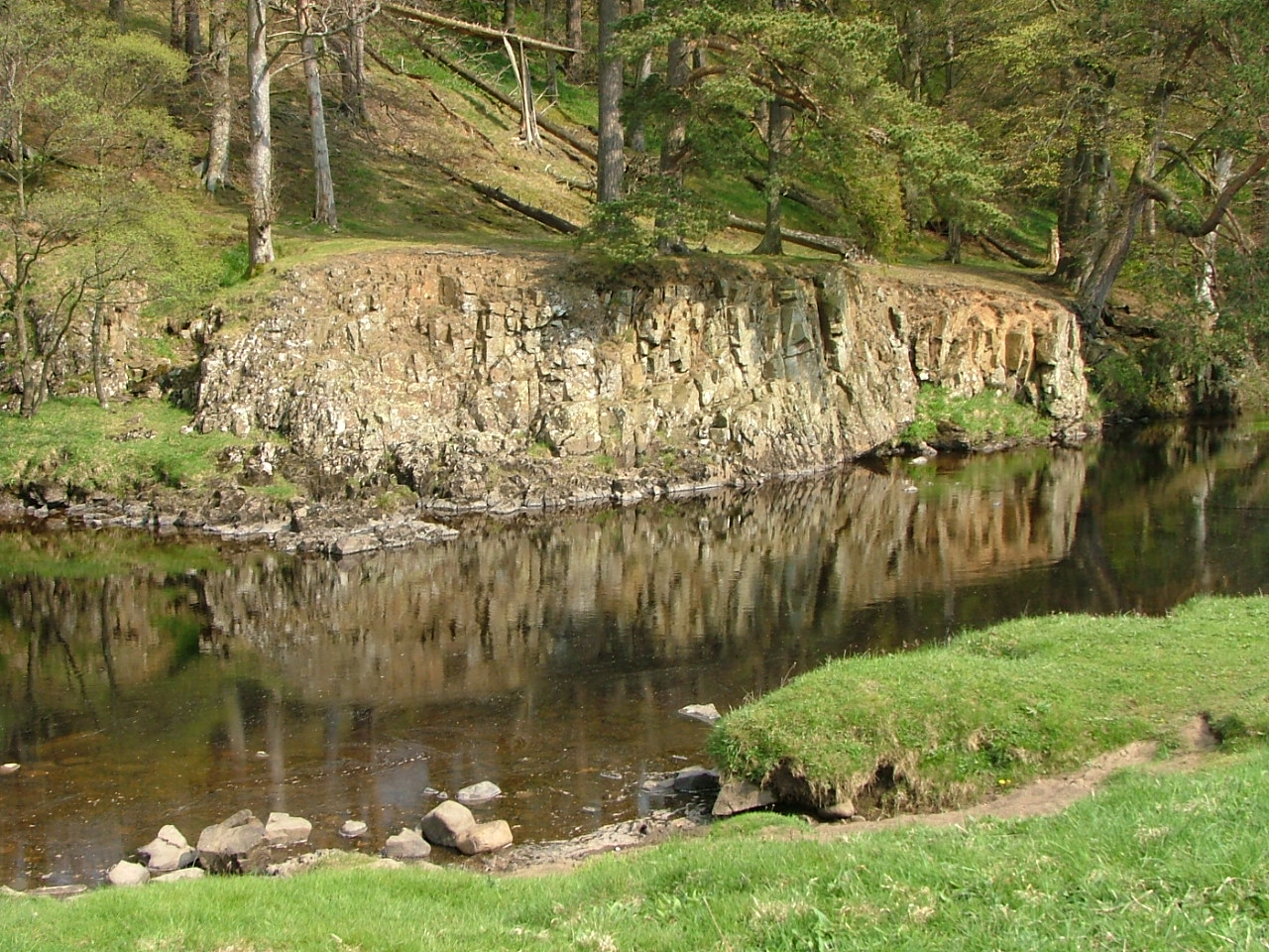
Over Abbey Bridge and the river started to flow through a gorge lined by rectangular limestone slabs –difficult to get photos of it because most of it was hiding behind trees. For some reason, I wrote in my notes that it was like Nepalese river the Dudh Kosi. Looking at photos on the internet now, it doesn’t look anything like that. Something in the way it flowed slowly, darkly, silently and brown through the rocks made me think of something from my youth in Nepal. All staggeringly beautiful, and even more so at the aptly name “meeting of the waters”, where the River Greta, which I had encountered in 2006 in Bowes when walking the Pennine Way, joined the Tees. A big sign told me that I wasn’t allowed to go down to the river, but I ignored that (not for the first time today) – a confluence of smashed square slabs – like some ruined cathedral. It’s difficult to imagine that the slabs are not man-made, but I don’t think they were.


And then suddenly up and out into a violent yellow field of rape, a field of llamas and heading up to a field path overlooking the valley occupied by two large black cows (with horns). Coming back down to the river, the path crosses the Whorlton Suspension Bridge – built in 1831 when crossing it cost 1d for any “foot passenger” (more for horses and cows). Nowadays it is advised as a “weak bridge” – certainly it seemed quite “flexible”, and the road bit was made up of wooden slats, and you can see why it is suggested that only one car should cross at a time.


The path then dives into another stunning riverside ramble through wild garlic and bluebells. An overgrown old house stood sentinel at a vast promontory sticking out into the river – if it had ever been occupied – what a stunning place to live! Then the path doubles back and climbs up to fields and it all changes again.


I decided to take a detour to hit the pub in Winston – easy enough to find the path over the fields, but the pub was shut (that it was shut on Sunday lunchtime on a bank holiday weekend suggests that it might have been shut for good). Still the Church of St Andrew, perched on the side of the hill, seemed worth the detour, but it meant I had to join the busy A67 for a stretch before the path headed off from a layby back down to the river. Another dismantled railway line (this one Darlington to Barnard Castle) crossed the river at the West Tees Bridge – this time the bridge remaining intact, if overgrown. Walking the other way afforded a small section of tree lined path before once again hitting the A67, and although the map suggested that the path would come away from the road, I didn’t find it, and it wasn’t long before I was walking into Gainford, where two pubs meant that at least one would have to be open.


It was the Cross Keys I hit first in Gainford, and the sign saying “a welcoming atmosphere” was promising. Hmmm – the bar was full of people watching the Man Utd/Arsenal match so not much welcome there, so I went outside in the sun. One of the smokers was staggered at the size of my boots (not quite sure why), and he had never heard of Saltaire (“is that in Lancashire?”). As per normal, the post pint afternoon stroll in the sunshine was a little woozy, but I only had three miles to go.


This section of the path was festooned with signs saying it was a private riverbank, and so – red rag to a bull – I descended to it for a long and beautiful rest in the sun. So beautiful in the warm and hazy sunshine – not unlike the river me and Grumpus had found some years ago between Slovenia and Croatia. Sadly it was not far to Piercebridge and the George Hotel – yippee – the woman behind the bar had heard of Saltaire. In fact, she knew someone who lived in one of the flats in Salts Mill. It was a beautiful evening by the river, but now only a few short miles to go.


Day twelve Monday 2nd May – Piercebridge to Low Coniscliffe – 5 miles


My original plans suggested that it was only 2 miles from Piercebridge to Darlington Station and that I would deal with these before the 10.13 train back home. Turned out that it was actually about 9 miles. I had booked on to the 12.11, and I wasn’t confident of getting there in time. So I checked bus times, and worked out that I’d be comfortable if I walked 5 miles to Low Coniscliffe and caught the bus from there.


A short stretch of river walking akin to the previous day to take me into High Coniscliffe (where the pub was very definitely closed down) and then the river changed again in this final stretch – now a broad and slow moving mature river, meandering around south of Darlington. I was keeping up a pace conscious that I needed to catch the bus. I could have taken a detour to cut off some of the final loops in the river, but I didn’t and was rewarded with some lovely final river walking and wild vegetation in a loop that saw me walking briefly in completely the wrong direction. A broad straight stretch and then I was under the A1M (audible some time earlier) and then I was there (although I found one last spot to head down to the river to say goodbye.


Of course, I had to wait about a half hour at the bus stop, but that gave me time to put things away and adjust myself. I was glad I didn’t take the walk on into Darlington because there didn’t look like there was anything to see, and I was in good time to catch my train.
Two great walks – blessed by some of the best weather I’ve walked in – and I was really pleased that my back, knees and shoulder just about stood up to the pressure. Tough to get back into work again – and I have now made an arrangement with my friend Richard to do the Three Peaks Walk with him in September – 21 miles and three tough climbs … can’t wait.